Cora Gold Limited (LON:CORA), the West African focused gold company, has provided an update on recent exploration work conducted at the Company’s Madina Foulbé Exploration Project in eastern Senegal. Madina Foulbé is located within the Mako Gold Belt of the Kédougou-Kéniéba Inlier in close proximity to several Tier 1 gold deposits (see Figure 1) and recent exploration has confirmed the Project’s large scale gold mineralisation potential.
2024 and 2025 Exploration Overview:
2024 Drill Programme
● June 2024 reconnaissance reverse circulation (‘RC’) programme tested nine previously untested targets at the Tambor Target (see announcement dated 9 July 2024), 1 of 4 main targets at the Project.
● 6 out of 10 drill targets returned economic/anomalous gold grades.
● Best intersection: 10m at 4.41 g/t gold (‘Au’) from 41-51m (MFC0013) – hole ended in mineralisation as did 50% of holes.
● Results defined a large gold-rich system across a 2.3km x 2.3km area, much of which remains untested at surface and depth.
2025 Exploration Work
● Recent work focused on each of the four key targets: Tambor, Tombolo South, Madina and Diombalou.
● Activities included a review of historical data, reinterpretation of regional magnetics, and first-pass multi-element soil and lithology geochemistry.
● The objective of this work was to assess the applicability of the Company’s P-XRF analyser (a handheld instrument that uses X-ray technology to perform rapid and on-site elemental analysis of materials, providing real-time data for identifying elements and their concentrations) as a reconnaissance tool to assist in refining and identifying new drill targets.
Target Overview and Highlights:
● Tambor – significant gold in soil anomaly, 3km x 1.5km at >20ppb;
o Four key zones of interest have been identified from the combined analysis of the drill assays (gold and multi-element geochemistry) and recent multi-element soil geochemistry results.
o Gold preferentially is hosted by units of mafic composition located in the central portion of the gold anomaly, with additional zones of gold mineralisation occurring in schists and felsic intrusive units (Tonalitic composition).
o Arsenic soil anomalies are coincident with the best drill results; these anomalies may show the direction and continuation of gold mineralisation as intersected by the 2024 drilling.
o Highest priority zone of interest is the central mafic area (1km x 800m) which incorporates 2024’s drill targets of; Target 1: 10m* at 4.41 g/t Au, 48m* at 0.47 g/t Au, 11m* at 0.65 g/t Au; Target 5: 31m* at 0.29 g/t Au, 15m* at 0.40 g/t Au; Target 3 west: 13m* at 0.2 g/t Au; Target 3 east: 0-40m of strong argillic alteration with high iron (‘Fe’) (possible Jarosite = oxidised sulphide / mineralisation), where ‘*’ denotes holes ending in mineralisation
o New key zone of interest identified from the recent multi-element soil sampling programme; new and untested high grade arsenic anomalies (+/- bismuth, molybdenum and tin) identified within the central mafic area
o Three other zones of interest; 2024’s drill Target 8 (gold at lithological contact, arsenic anomaly 400m long and open to north and south); Target 9 (widespread distribution and high values of arsenic over 200 x 300m, open in three directions) and Target 2 (intersected broad zones of gold mineralisation associated with sheeted veins within granitic units).
● Tombolo South target – gold in soil anomaly, >3km x 600-1,000m at >20ppb
o Two key zones of interest along the N-S, Sabodala Shear Corridor ‘SSC’
i. High grade gold zone at surface in mafic volcanics, with corresponding Bismuth soil anomaly 1.5km long, open to north and associated with prominent magnetic low structure. Target is not drill tested
ii. Gold mineralisation within granitic host unit, with corresponding 800m x 800m gold in soil anomaly. Target is not drill tested.
● Madina target – gold in soil anomaly (2km x 1.3km at >20ppb)
o Corresponds to regional lithological contact and a regional N-S structure. Soil sample multi-element study and previous shallow Rotary Air Blast ‘RAB’ drilling indicate that the in-situ source of the gold anomaly is interpreted to be located west and beneath the shallow RAB drill holes.
o Outcropping mineralisation present at surface with no artisanal workings present.
● Diombalou target – gold in soil anomaly (2.5km x 1km at >20ppb)
o Located along the same regional N-S structure (Léoba-Moussala Shear Zone ‘LMSZ’) as Madina target, mineralisation outcrops at surface, target has not been drill-tested and no artisanal workings exist.
Bert Monro, Chief Executive Officer of Cora Gold, commented, “Work at Madina Foulbé continues to show the promising potential of a large gold rich system. The results received to date are even more significant due to the Project’s location in a geological province proven to be elephant country as evidenced by the presence of multiple world-class gold deposits. Whilst our primary focus as a company remains on commencing mine construction at our flagship Sanankoro Gold Project, it’s great to see our exploration team identify strong targets for future drilling, which present the Company with exploration upside that could be transformational.”
Murray Paterson, Head of Geology at Cora, commented: “With four strong gold anomalies identified at Madina Foulbé – all of which have yielded encouraging results from early-stage exploration – we are seeing highly encouraging signs of significant underlying gold systems. Tambor is the largest of the four, and now that we have established a clear link between the mafic lithologies and gold mineralisation over a large area, it is an extremely promising sign of what might lie at depth underneath the gold soil anomaly. For our team, this is an exciting drill target in an easy to explore area, and we are eager to pursue further exploration activities with a view to expanding our global resource inventory.
“In addition to Tambor, we have a further three prospective gold soil anomalies present, all of which indicate they have in-situ resource potential, which further underpins Madina Foulbé as a highly valuable and high reward project for the Company. We are excited to share our progress as we advance each target.”
")
Figure 1. Location map of KKI, Tier 1 deposits and Cora Gold’s Madina Foulbé exploration permit
Further Information
Madina Foulbé Project Background
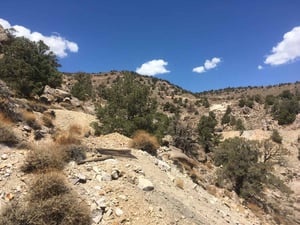
The Project is located in eastern Senegal in close proximity to the country’s border with Mali. The permit is connected by a well maintained (by the government) road, approximately 50km south of the Senegalese town of Kidira, located on Senegal’s national route 1, a major border crossing into neighbouring Mali. Geologically, the Project is situated in the north/west area of the KKI, approximately 27km directly west of the Sadiola Gold Mine (see Figure 2 below). The Project is relatively un-explored despite the regional work programmes and the reconnaissance drill programmes completed since 2018 by the Company. Located within the Project area are four principal gold in soil anomalies (Tambor, Tombolo South, Madina and Diombalou) with only the Tambor gold in soil anomaly having been tested by shallow reconnaissance RC drill holes. Topography of the area is flat to slightly undulating, with easy drill rig access to all target areas by local roads.
")
Figure 2: Regional Geological map of the KKI, showing Cora’s Madina Foulbé permit boundary (from Dioh et al 2006). Shown are the 2 major N-S regional structures, western LMSZ and eastern SSC that transect the Madina Foulbé permit on which all 4 gold anomalies are located.
2025 exploration work update
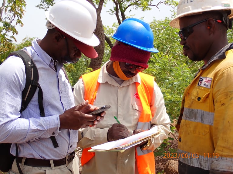
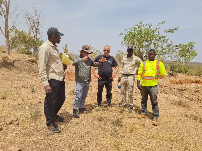
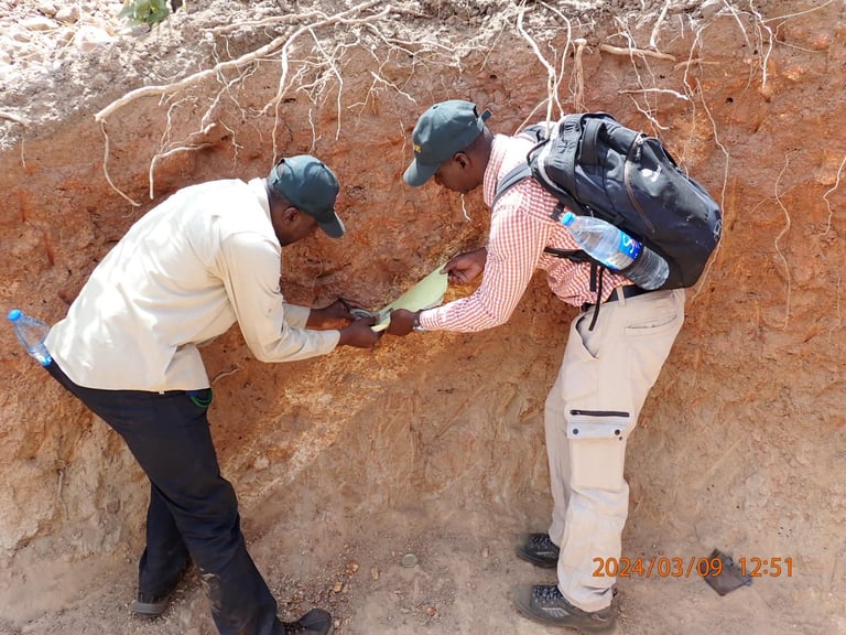
The Company’s exploration team has been actively conducting systematic and phased field exploration activities at the Project to advance the four main targets of Tambor, Tombolo South, Madina and Diombalou (see figure 3 below). The 2025 exploration work programmes at the Project involved reviewing all previous historical data, regional magnetics and completed an initial multi-element soil geochemistry study to provide another data set to supplement the existing, gold in soil, drill, rock chip, trench and RAB data. Below is an outline of the 2025 field work carried out to date:
● Soil and rock chip sampling programmes were carried out at Tambor, Madina and Tombolo South.
● Soil samples were analysed by the Company’s Portable X-Ray Fluorescence ‘P-XRF’ analyser for multi-element geochemistry and rock chip samples were sent for fire assay for gold concentration and ICP-MS (4 acid) for multi-element geochemistry.
● In total 512 soil and 20 rock samples were collected and submitted for analysis, with the majority of samples collected from Tambor.
● Results from the P-XRF and ICP-MS analysis confirmed the elements associated with gold, the width and trends of the mineralisation and the location of lithological contacts. The associations made through this work should support more targeted and lower cost exploration in the future.
")
Figure 3: Map showing the location of the four principal targets and their associated gold in soil anomalies (ppm) at Madina Foulbé
The following is a summary of the main exploration targets, none of which have mineral resources defined.
Tambor
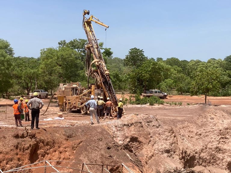
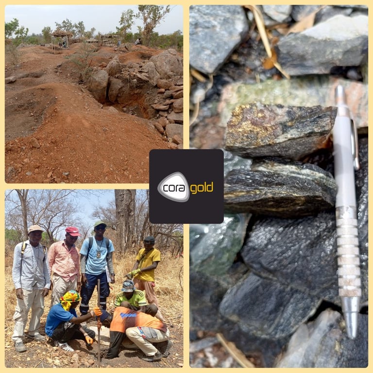
Exploration at Tambor is the most advanced of the four targets at the Project due to the work activities completed at the target in comparison to the other three. Work has focused on Tambor due to the large gold in soil anomaly (>20ppb), 3km long x 1.5km wide, max value = 1.429 g/t Au and anomaly mean value =64ppb Au (from 415 samples), with the anomaly not closed off to the north or south. Supporting the soil anomaly, Toro Gold (previous operator of the permit) drilled 59 short RAB holes which intersected intervals of mineralisation (see announcement dated 30 March 2020). The Company has completed geological mapping, termite mound and rock chip sampling from within the soil anomaly and its immediate surrounding area. The best surface grab samples returned, 95.3 g/t Au at drill Target 1; 16.2 g/t Au and 2.86 g/t Au at drill target 8; and 7.2 g/t Au at target 9. Regional geophysical data sets show a large circular feature coinciding with the Tambor gold-in-soil anomaly, which in addition to the regional (+200km in length) scale north-south trending fault system, the SSC, is interpreted from regional structural maps to either cut directly through the centre of the gold in soil anomaly or pass very close by. The massive gold surface anomaly, widespread distribution of gold in rock chips, air magnetics signature, regional structural interpretation, and variation in lithology units, all support the required geological architecture to potentially form a large orogenic gold system at Tambor.
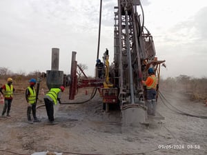
Using the RAB drill results, rock chip assays, gold in soil results and field observations, 10 targets or areas of interest were identified for drill testing, as per Figure 4 below. To date, the Company has drilled 48 RC holes at Tambor; the first programme of 8 holes (636m) in 2020, was stopped prematurely due to the outbreak of the Covid-19 pandemic. This first drill programme tested the Target 2 area, with best results of 47m at 0.63 g/t Au from 27m including; 1m at 16.4 g/t Au from 40m in hole MFC007, 36m at 0.53 g/t Au from 6m including; 3m at 3.78 g/t Au from 12m in hole MFC001 and 27m at 0.47 g/t Au from 45m in hole MFC002 (see announcement dated 6 May 2020). Gold mineralisation at Target 2 is within felsic intrusive rocks of granitic and pegmatitic composition, with mineralisation controlled by sheeted quartz veins that host broad low-grade zones of gold mineralisation trending E-W (semi parallel to the gold in soil anomaly long axis). Preliminary gold recovery test work was also carried out on 24 mineralised samples from this first drill programme; the samples were sent for bottle roll analyses to check the results against the fire assay results in case of coarse gold being present. The average gold recovery for the 24 samples was 98.5%, from samples whose average gold grade was 0.57 g/t Au. These results are an early indicator that the gold is liberated (not encapsulated by pyrite / arsenopyrite), not preg-robbing and easily leached by cyanide. However, further metallurgical test work is required to validate the metallurgical recoveries, via cyanide-in-leach or via column test work for recovery via heap leach.
") |
Figure 4. Tambor gold anomaly map with 2024 drill targets areas
The Company’s second drill programme, which consisted of 40 holes (2,018m), was completed in June 2024 and tested nine previously untested targets in addition to a second phase of follow up drilling at Target 2, (see announcement dated 9 July 2024). Six out of 10 targets returned anomalous to economic gold grades underneath the massive gold in soil anomaly. Target 1 returned the best results, with every hole intersecting near surface mineralisation, either economic grades or anomalous mineralisation (>0.1 g/t Au). In total, 50% of the programme’s holes end in economic or anomalous mineralisation i.e. >0.1 g/t Au within 4m from the end of the hole. The drill programme was successful in confirming the presence of in-situ gold mineralisation under the surface gold anomaly.
All the drill samples from the 2024 RC drill programme were sent for fire assay and multi-element geochemistry analysis (ICP-MS 4 acid), the lithogeochemistry interpretation of this data by Dr. Nick Oliver of HCOV Global, showed that multiple zones of gold mineralisation occur within a complex arrangement of lithology units (see announcement dated 7 October 2024). The other main outcome from this multi-element study was determining the mineralisation model responsible for the distribution of gold and its host lithologies, which indicated that gold mineralisation is associated with an Intrusion Related Gold System (‘IRGS’) possibly overprinting an original orogenic gold system. IRGS systems can be massive in size, for example Morila (Mali); Donlin Creek-Fort Knox-Pogo (Yukon / Alaska); and Kidston (Australia).
In early 2025, the Company carried out an initial multi-element soil geochemistry sampling programme, using the Company’s own P-XRF analyser. Seven soil grids were planned at Tambor, using 50m line spacing and 25m sample spacing, with the grids located over seven drill target areas (Target 1, Target 3 east and west, Target 5, Target 8, Target 9 and Target 10). In total 450 samples were collected for multi-element analysis as part of the programme. The P-XRF analyses were run under laboratory like conditions in the Company’s office in Bamako, using calibration disks, standards, blanks and field duplicates every 10th to 20th sample to ensure data QAQC and data stored in the Company’s Datashedtm database, administered by a third-party database administrator. These P-XRF results were analysed in ioGAStm software to show their concentrations, distributions and association to gold in soils and to the 2024 RC drilling multi-element and gold results.
Following is a brief summary of each of the drill targets at Tambor now incorporating the P-XRF soil geochemistry results. Where drill Targets 1, 5, 3 west and east are now combined to form the central mafic area “CMA” of interest. Drill Targets 8 and 9 remain as their own separate areas of interest due to their host lithologies not being of mafic composition, they are spatially 800m to 1.4km distance (opposite directions) from the central mafic area, and, they have different multi-element associations whose distributions are also different than the central mafic area. No soil sampling was carried out over drill Target 2 which is scheduled to be completed in the next phase of exploration at Madina Foulbé.
Target 1 (5 RC holes): the location of the best drill results of the 2024 drill programme; 10m at 4.41 g/t Au, 48m at 0.47 g/t Au, 15m at 0.53 g/t Au and 11m at 0.65 g/t Au with all five holes ending in mineralisation i.e. >0.1 g/t Au. All mineralised intervals were associated with units of mafic composition (three mafic units have been identified from the HCOV Global lithogeochemical study). From the P-XRF soil sample study, a strong coherent arsenic anomaly (see Figure 5 below) is located over the drill holes and the high-grade rock chip results. In Figure 5 below, Target 1 mineralisation (black dashed line) trends N/W – S/E and is open along strike, approx. 500m in length and shows that the arsenic anomaly is open in both directions.
Target 5 (3 RC holes): intersected broad lower grade zones of 31m at 0.29 g/t Au and 15m at 0.4 g/t Au was intersected in two holes with all three holes ending in mineralisation (see Figure 6 below). Similarly to Target 1, mineralisation was hosted in rocks of mafic composition.
Target 3 west (6 RC holes): only two holes along this line of six shallow holes intersected mafic lithologies, which also corresponded with the best gold intersections in this drill line of 13m at 0.2 g/t Au (hole ending in mineralisation) and 6m at 0.28 g/t Au (at top of the hole). The P-XRF soils study over this area, highlighted a new high arsenic anomaly (see magenta circle in Figure 5), 150m S/E from the two holes at target three west that intersected mafic units with anomalous gold mineralisation and correspond to a low level surface arsenic anomaly.
Target 3 east (5 RC holes): returned multiple broad anomalous grade intercepts of 7m at 0.23 g/t Au, 21m at 0.1 g/t Au, 14m at 0.19 g/t Au, 20m at 0.16 g/t Au, 19m at 0.10 g/t Au, four out of the five holes (40m deep) ended in mineralisation. These holes intersected granitic and pegmatitic lithologies not mafic lithologies, however of interest is the geochemistry of the western most hole of this line (MFC0044). It is the only hole of the entire 2024 RC drill programme to have argillic alteration with high iron (interpreted to be jarosite, which is a common mineral formed from the oxidation of sulphides i.e. pyrite) for the entire hole i.e. 0-40m. Due to the shallow depth of weathering at Tambor, this hole could be significant due to what could be located deeper below or that the hole intersected a structure that may have cut through sulphide and possibly gold mineralisation (see Figure 6 for the location of this hole). From the P-XRF soil study it was also shown that to the immediate west of the Target 3 east drill fence, another strong arsenic anomaly is located (see red circle in Figure 5). As with Target 3 west, the Target 3 east drilling could be close or over the top of deeper mineralisation.
Target 8 (2 RC holes): 2024 drill results from the two holes returned 19m at 0.49 g/t Au and 17m at 0.24 g/t Au, with the former interval ending in mineralisation. The P-XRF study showed that mineralisation is located proximal to a major lithological contact. Based on the soil geochemistry, a distinct arsenic anomaly corresponds to the drill results and rock chips, the anomaly extends for 400m and is open to north and south (see Figure 5). From the ICP-MS data study and logging, the main host to mineralisation were schist units with minor pegmatite intervals.
Target 9 (2 RC holes): From the 2024 drilling, intervals of 29m at 0.71 g/t Au (from surface) and 8m at 0.24 g/t Au (hole ended in this mineralisation). From the P-XRF soils geochemistry study, arsenic is elevated over the entire soils grid area of 200m x 300m, and is open to the north, west and south. Lithologies of predominantly granitic compositions were hosts to the gold mineralisation with minor occurrences of pegmatites, as determined from the lithogeochemistry study by HCOV Global. The current size and shape of the arsenic anomaly would suggest a separate mineralising system responsible for the widespread distribution of arsenic; however further soil sampling is required to assess whether target 9 is connected in any way to the CMA.
")
Figure 5: Map of Tambor arsenic anomaly from P-XRF soils analyses with central mafic area shown (blue line), where the black dashed lines represent the orientation of the mineralised intersected in the 2024 reconnaissance drill programme.
")
Figure 6: Oblique 3D view of the central mafic area, displaying drill holes filtered lithology, showing only the units of mafic composition as determined by the lithogeochemistry study by HCOV Global, the gold intersections for these mafic intervals from the holes within the central mafic area are also shown.
Madina
The Madina target is located on the western side of the Project area (18km S/W from Tambor) and is defined by a large gold in soil anomaly (>20ppb) 2km long x 1.3km wide, max value = 0.609ppm and anomaly mean value = 45ppb (from 233 samples). The soil anomaly corresponds to lithological contact between a granitic unit (to the west) and mafic volcanics and quartzite to the east. The anomaly is also coincident with a major regional N-S structure, known as the Léoba-Moussala Shear Zone ‘LMSZ’, cited Dien et al, 2012, International journal of geosciences, (see Figure 2, regional geology of KKI).
In 2013, Toro Gold completed three lines of shallow vertical RAB holes (45 holes), see Figure 8 below, results (from 3 metre sample lengths) were from the southernmost drill fence: 3m at 1.88 g/t Au, 3m at 1.07 g/t Au and 3m at 0.47 g/t Au, these results were from the last two western most holes along the fence. With hole MFB025 ending in mineralisation at 21m deep (second last hole). From the middle drill fence, 3m at 1.65 g/t Au and 3m at 0.54 g/t Au were recorded amongst other anomalous intervals i.e. 0.1-0.2 g/t Au with one hole (MFB020) ending in mineralisation. From the northernmost line, no significant intercept was recorded i.e. >0.5 g/t Au, however there were anomalous gold intervals intersected and hole MFB002 and MFB011 ended in anomalous mineralisation. Due to the shallow depths (<=21m) of the RAB holes, they were successful in proving in-situ gold mineralisation existed beneath the soil anomaly however the above results, indicate that deeper drilling is required to test the depth extents and strike continuity of the in-situ mineralisation.
The Company has carried out field geological mapping, termite mound sampling, rock chip and an initial multi-element soil sampling programme for P-XRF analysis. Assay results from the rock chips confirm widespread surface mineralisation associated with the interpreted N/W oriented lithological contact (refer to Figure 7 below), this contact is supported by the clear distinction in magnetic response underneath the gold in soil anomaly. The best of the rock chips results was 0.69 g/t Au within mafic volcanics, 0.72 g/t Au within the granitic unit, 0.51 g/t Au from quartz vein and 0.13 g/t Au from within the quartzite. Topography is generally flat over the soil anomaly but does rise and become undulating to the west, once passing over the lithological contact into the granitic unit. Importantly there is no historical or active artisanal workings at the Madina target.
The Company’s recently completed P-XRF soil sampling programme consisted of three sample lines (500m apart) with 100m sample spacing, from which 22 samples were collected. From the multi-element analysis of the soil samples, it was clearly visible that arsenic and bismuth were the two most important elements associated with gold. With bismuth values elevated on both sides of the contact while arsenic was only found east of the contact in the mafic volcanics and quartzite.
Combining the observations from the P-XRF data analysis and the RAB drilling results, it is interpreted that the RAB drill holes were not deep enough and did not test the full extents of the gold anomaly to the north but also to the west into the granitic rocks. This theory was supported by the distribution and elevated values of the bismuth within the granite, suggesting it may also be mineralised.
The next phase of work is being planned which will include expanding the P-XRF soil sampling grids to cover the entire Madina gold in soil anomaly and sending lithology and mineralised samples for multi-element geochemistry analysis by ICP-MS (4 acid).
")
Figure 7: Gold in soil sample map of Madina target, showing location of RAB holes (black dots), mineralisation contact (black dashed line) background is regional air magnetics.
")
Figure 8: Oblique view of historical Toro RAB holes drill sections (looking north) at Madina, RAB holes coloured by gold assays (3m intervals) and dashed back line represents possible mineralisation contact
Tombolo South
The Tombolo South target is located approximately 13km to the south of Tambor, and is located along a major N-S trending regional structure, the Sabodala Shear Corridor ‘SSC’, cited Teranga Gold, Sabodala Gold Project Technical Report, June 2013 (refer to Figure 2, regional geology of the KKI) which controls the distribution of the gold in soil anomaly, 3km long x 600m wide (>20ppb), max value = 0.351ppm and anomaly mean value = 30.4ppb (from 59 samples).
The main lithologies at Tombolo South are dominated by two granitic units, east and west bounding mafic volcanics in the middle. There is little to no weathering with fresh rocks metres from the surface.
Two minor artisanal workings exist in the target area, one within the western granitic unit with minimal activity, the other small shallow surface working has been abandoned, due to hardness of the rock (fresh and silicified). There has been no previous drilling carried out at the target despite many good rock chip samples collected, including 57.2 g/t Au (from within the granitic unit 600m along strike on the same structure as the abandoned artisanal working), 11.8 g/t Au, 11.4 g/t Au, 5.99 g/t Au and 3.97 g/t Au (all four samples from mafic volcanic within the abandon artisanal working), 4.21 g/t Au (north of the artisanal working, potentially along the same structure). Geological mapping has confirmed the presence of the structure on which the high-grade rock chip samples were collected, see Figure 10 below. The regional air magnetics also confirm the location of the high-grade gold bearing structure, and its strike continuity. The regional air magnetics show a clear and distinct NNE trending linear magnetic low feature coincident with the mapping and rock chip samples (refer to Figure 9 below).
As a result of the recent P-XRF soil sampling programme, where 40 samples were collected along 100m sample spacings, from four lines, spaced 500m apart (2km of strike coverage), the soil sample grid was located over the prominent NNE trending magnetic feature and the gold in soil anomaly. Rock chip samples were also collected and one sample taken from the abandoned artisanal working, returned 11.4 g/t Au, 1.01 g/t silver, <0.2ppm arsenic (very low), 18.65ppm bismuth, 1.59ppm molybdenum, 24.5ppm tellurium and 7.1ppm tungsten.
The lack of arsenic present at Tombolo South signifies a different mineralising system or greater depth within the system than the mineralising systems at Madina and Tambor targets. Due to the association of bismuth with gold in the rock chip sample, likely implies that the bismuth soil anomaly from the P-XRF analysis corresponds to gold distribution in the underlying rock, as bismuth is an immobile element during weathering. The bismuth soil anomaly is approx. 1.5km long to the south of the abandoned artisanal working, and there were no soil sampling lines extending north of the abandoned workings and the structure may continue further north, with mineralisation open. A future soil sampling programme will be carried out along strike to the north to assess the northern continuity of this gold and bismuth bearing structure.
The second and partially active artisanal mining area within the western granite located 2km to the S/W from the abandoned workings, is located within an 800m x 800m gold in soil anomaly. The Company’s geologists recently observed hand mined material being crushed and panned, with visual gold seen in the pan. This area was not covered by the P-XRF soils grid, as it was only visited on the last day of the field work programme.
The next phase of exploration work planned at Tombolo South is to continue with the multi-element soil geochemistry grids to the north and west of the current grid, infill areas of interest, collect additional rock chip samples for multi-element analysis (ICP-MS 4 acid) and prepare and finalise the geological fact mapping.
")
| Abandoned small artisanal working |
")
Figure 9: Map of Tombolo South exploration target with air magnetic image in the background, gold soil sample results (ppb) and P-XRF grid lines (brown squares). Yellow dashed line represents high grade gold-bismuth bearing structure and magnetic low. Red ellipse = abandoned artisanal working. Red train track style line = 2024 permit boundary
")
Figure 10: Geological fact map completed by Cora’s Senior exploration geologists surrounding the high-grade artisanal workings (abandoned) at Tombolo South. Yellow dashed line indicated the same high-grade structure as shown in Figure 9. This target has not been drill tested.
Diombalou
Diombalou target is located 6km north along strike of the Madina target and along the same N(NNE)-S trending major regional structure that runs through the Madina target, known as the Léoba-Moussala shear zone ‘LMSZ’, as shown in Figure 2 (regional geology map of KKI). Diombalou’s gold in soil anomaly is 2.5km long x 1km wide (>20ppb Au), max value = 0.164ppm and anomaly mean value = 26ppb (from 60 samples). This target hasn’t been drill tested previously and there are no historical or active artisanal workings.
The anomaly area mostly has flat topography, with the surface covered by soils and some outcrops of lithology and mineralisation. Two rock chip samples have been collected, returning 0.28 g/t Au from within quartz veins at the southern end of the anomaly and 0.15 g/t Au taken from the northern end at a contact between granitic rocks and pegmatite. The low-grade nature of rock chip samples is reflected in the lower grade nature of the gold soil anomaly (average 26ppb Au). Geological mapping and termite mound sampling has been carried out by the Company’s exploration geologists, who also observed the same sequence of lithologies as at the Madina target, granitic unit to the west, and mafic volcanic with quartzite rocks to the east.
The regional air magnetics (refer to Figure 11, below) shows a distinct NNE trending magnetic feature that may be related to mineralisation. The gold in soil anomaly at Diombalou is open to the north and to the south in an NNE orientation. Further mapping, rock chip and soil sampling (with P-XRF analysis) is being planned to understand the geology and mineralised structure beneath the soil anomaly before testing with a reconnaissance drill programme in the future.
")
Figure 11: Map of Diombalou exploration target with the air magnetic image in the background, gold soil sample results (ppb) as coloured dots
Future Exploration Programmes
As part of Cora Gold’s wider exploration strategy, utilising the information and knowledge gained from all previous exploration programmes completed at Madina Foulbé, especially the multi-element soil geochemistry, will drive the next phase of exploration being planned to advance the targets towards resource definition stage.
Further exploration updates will be provided in due course.